Best equipment value choice for documenting underground utilities on farm property

Hi there.

I posted about my situation in the past, but am now trying to narrow down equipment. . .

I have a 225 acre property that has substantial existing water, electric and fiber optic lines that I want to ultimately map out. I am planning to lay down some existing lines in the near future and I want to document the line locations with RTK GPS equipment every x feet before filling in the trenches so that I will have precise horizontal and vertical location information that I can map out for the property. I also have plans to plat out a future RV park area with the same equipment.

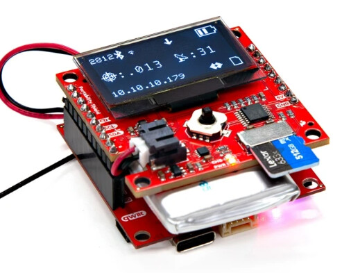
I have been researching equipment and am trying to get to the point of purchasing. I have looked at the Sparkfun offerings and there are certainly multiple choices there. I have also looked elsewhere. Of the Sparkfun offerings, the Facet seems to hit the sweet spot as far as ease of use and value are concerned. I have tried to compare it to value products on Amazon and have found the E1 by Singular XYZ to be an apparently comparable product with the following differences. The E1 seems to have:

  • Longer battery life
  • Tilt compensation
  • Built in UHF radio
  • Included software
  • A price that is perhaps $200 more

Of these points, it seems like the tilt compensation would be a real nice addition. I know that the Torch has that but I’m not sure that I can justify paying such a premium for that unit, even though it sounds like a great solution for me. Because I don’t have phone service on parts of my property, it seems like I’m limited to using a base station with a UHS or LoRa connection to get the RTK fix. Having that built in to the unit is nice. As far as the included software is concerned, I’m not sure how it compares to the free SW Maps.

I don’t know how to judge the Facet or the E1 for their respective ability to get workable signals under tree canopy, but that would be important to me.

Can anyone provide guidance as to what is and is not important for the use cases that I mentioned as it relates to the Facet and competing products? I am a complete noob to all this so there will be a learning curve for me and ease of use is desired. I suspect that support through this forum would be better than what I could get through a company based in China so that is likely a win for the Facet. What else do I need to be consider? Feel free to steer me away from both of these products if there is a better value choice out there.

Thanks for any insight you can provide. I suspect that other people new to this world will benefit from what you have to say here.

I’d like to drill down a little deeper on that comment, because it has a big impact on your project.

As you know, it’s time to choose between a network rover (we call it RTN), or a Base/Rover Pair.

RTN requires internet service (typically Cellular), but it’s not in the same realm as what’s required for Voice Communications on a cellphone. I’ve logged many RTN positions when my iPhone has 1 or 0 “bars” of service, using a Facet, Torch, or PostCard connected to the iPhone over Bluetooth and SW Map’s NTRIP Client.

[Warning: Personal Opinion] Don’t get caught-up with tilt compensation. I turn it OFF (when available) for all the GNSS devices I’m responsible for. Hold the rod plumb with a bullseye bubble, and use an accurate Rod Height :slight_smile:

If you want to jump right in and get your feet wet, it’s hard not to justify a PostCard + antenna and finding out for sure if Cellular/NTRIP works on your property. It’s a ridiculously cheap way to get “hands-on” with L1/L2/L5 RTN….using the smartphone in your pocket + SW Maps freeware.

Or you could start with a $740 Facet, to figure out if NTRIP will serve you on your property before heading down the Local Base + Rover path. Since you mentioned tree canopy, it’s worth noting the PostCard uses L5 - the Facet does not.

Eventually you might take what you learned from the PostCard and transition into purchasing a finished product, or simply put the PostCard in an enclosure and proceed with data collection.

First of all, thanks for the reply.

So, is that to say that the Postcard + antenna should perform better in a tree canopy environment than a Facet?

From reading about the postcard, it looks like they recommend the “Portability Shield” to facilitate taking it into the field. So the postcard plus portability shield plus an antenna is all that is needed, provided that you can get correction data via the net? We don’t have free correction data here in TN that I am aware of, so it seems like a base station should be in my future, regardless, but this is perhaps a good way to get started.

Why do you prefer to deactivate the tilt feature. To a newbie, it seems like that would greatly simplify things.

David

Na, I’m not ready to say that. I can say that I’ve had a postcard outperform a Facet under canopy in a couple of side-by-side tests using the same correction source at “almost” the same time. Other users have reported the opposite. There are so many factors in generating a RTK solution.

The only factual statement is the PostCard has the benefit of the L5 band, which “can” penetrate tree canopy better due to the wavelength. But in the RTK game of inches, we shouldn’t expect much, in terms of absolute accuracy, under tree canopy anyway. You have to be mindful of multipath. Just know that you shouldn’t trust an elevation under tree canopy.

Really, the main benefit here is you get an on-board battery charger with the shield, IMHO. You’ll be Bluetooth connected to the PostCard anyway, and have access to the same metrics displayed on the OLED screen of the shield. Once you step away from a network rover, the shield has more importance.

Performing GIS data collection, there are times that you need to adjust the rod height.

Many times you need to set the antenna directly on the asset, and need an effective 0’ rod height, but still need to account for the Electrical Phase Center (some distance above the mechanical phase center + it’s height above ARP). You can’t really do that “on-the-fly” if the instrument is performing tilt compensation, unless your data collector is hardware specific.

I’ve found that it’s best to simplify the field workflow. You’re dealing with mosquitoes, hot, cold, people asking questions, cell phone ringing, snakes, dogs, the boogeyman, etc. Plumb the rod and take the shot……takes about 3 seconds. The only thing I want my tech’s doing is temporarily changing the Rod Height when required, and be sure to change it back :slight_smile:

Many people love Tilt Compensation and swear by it, that’s why I tagged my comment with [Warning: Personal Opinion]. But if I can’t trust myself or someone working for me to hold the Rod straight - then RTK isn’t something I/they should be doing.

2 Likes