I’m using the u-blox ZED-F9P and the cheapest no-name saucer-type L1/L2 antenna I could find, to log data from a fixed location in 24 hour blocks. I send my RINEX .obs to the Canadian service from natural-resources.canada.ca (in my case using only GPS and GLONASS, not Galileo etc) for Static-PPP processing.
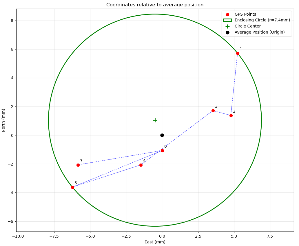
After getting seven days of data, I find the fixes are within a circle 7.4 mm in radius. Is that the expected result? I’m running the
data just a few hours after the end of each UTC day, so this is using “ultra-rapid” orbit data. My location has trees and houses at least partially covering most azimuthal directions up to 20 to 30 degrees above horizontal.
2 Likes
Hi John,
Personally, I’d say 7mm is a good result for a Multi-Path Environment ![]()
As you probably already know, you can resubmit your RINEX to process the 7 missions again with better orbit data.
Did you have decent agreement between the elevations?
Did you notice anything unusual in the Quality Reports?
1 Like
Your results are somewhat as expected. Take a look at a site like:
There are thousands of base stations with PPP time series data. I’d look at the fixed plate plots. You will see a bit higher position variation then what you got, but that’s because your sample size is tiny compared to multiple years for most of the sites. If you sampled for 20 days let alone 20 years your position spread would increase.
Be aware that some of the sites have poor data, some are near the edge of tectonic plates, and there are a host of other issues that a particular site might have. Click around and look at a variety of the sites. Maybe click on a bunch in your area to see what’s happening locally.
2 Likes
Wow, 7.4 mm radius over a week with a budget antenna and partial sky view? That’s actually super impressive. Honestly, with that kind of obstruction and using ultra-rapid orbits, I would’ve expected a bit more scatter. Shows how solid the ZED-F9P can be with clean static data and decent processing. Out of curiosity have you tried reprocessing with final orbit data to see if it tightens up even more?
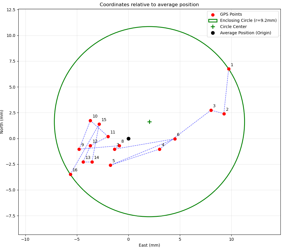
I’m up to 16 days now, and the total group radius is now 9.2 mm. It does not look random. There is a trend over time to the west, also slightly south, and the scatter is decreasing. In fact if I remove the first three points from the group, I would have only r=5.4 mm for the remaining 13 points.
Yes, I am interested to see what the result using final orbits would look like. Since my current data set goes right up to today, I think I have to wait a few weeks more for that.
I was also surprised how tight this group is. This is a slap-dash install, using a pipe resting on a 2x4 spanning the rungs of a stepladder. https://photos.app.goo.gl/YDYTHNRjn7iFU8cZ8
Each side of the the stepladder base is only 62 cm wide, and the antenna atop the pipe is at 4.73 m above grade. There is no foundation here, the ladder is just sitting on plain dirt, and it is on a slight slope as well! The ladder + pipe was adjusted to be accurately vertical initially but if over time, one side of the ladder feet sink just 1 mm into the ground more than the other, that 7.6x lever arm factor means the antenna will move 7.6 mm in that direction.